Land Navigation and Week 3 of DCC
On This Page
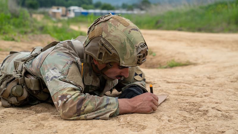
In this post, I discuss Week 3 of the Army’s Direct Commission Course, which focused on land navigation.
Yesterday marked the end of Week 3 of the Army’s Direct Commission Course, which puts me at the halfway point. In three weeks, I head to Charlottesville, Virginia, for the ten-and-a-half-week Judge Advocate Officer Basic Course.
The weather made this a strange week, but we still managed to finish land navigation and begin basic rifle marksmanship.
Land Navigation
As I described in my previous post, land navigation began the previous Friday with a group practice round. We picked it back up on Monday, this time split into two-person teams and working the course where our test would be held—a different one than we’d used the week before.
That first morning, the cadre gave us three hours to find four points. We set out in the dark and walked a few kilometers down the road to reach our first point; by the time we pushed into the woods, there was enough light to see. (Land navigation uses the metric system.)
Flashlights are allowed, but only with a red lens. Red light is far dimmer than the normal white light from a flashlight, but the sun comes up within an hour or so of starting.
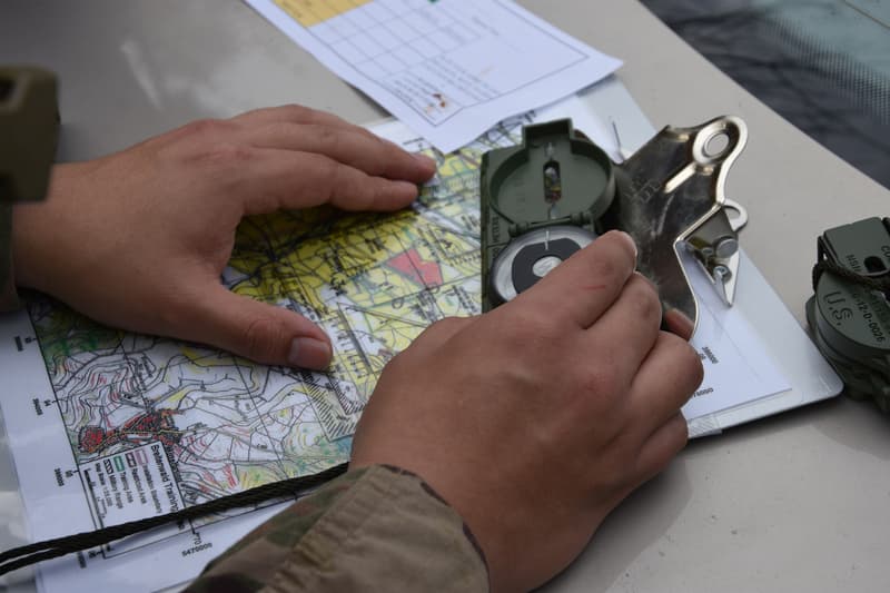
Finding Points in Land Navigation
When we finished, we broke for an MRE, and in the afternoon the cadre sent us out again: four more points in three hours. Below is one my partner and I tracked down.
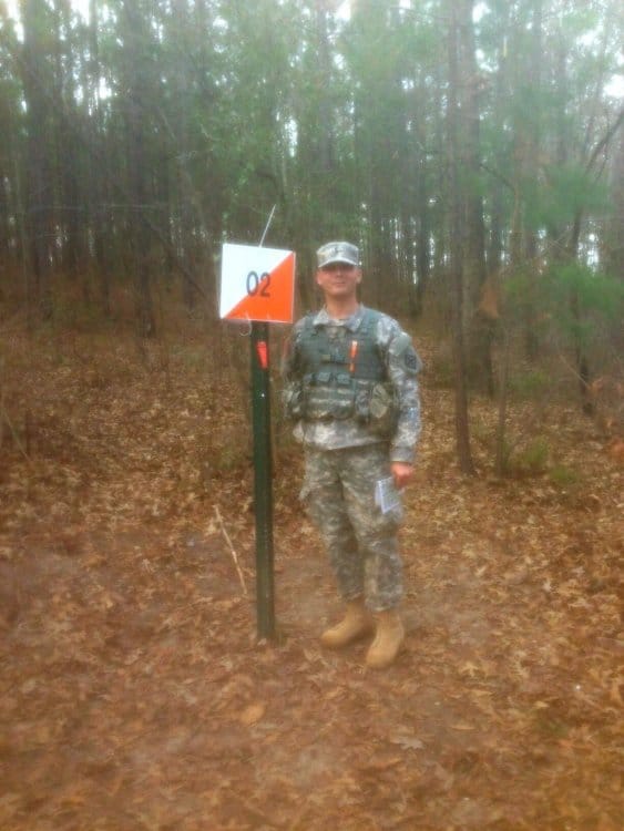
Some points were easy enough. Others sat in thick brush and stayed hidden until we were almost on top of them.
Overall, it was a lot of fun—though unlike our first course, the roads here were sand. Ten to fifteen miles of it can be genuinely taxing, and I found the woods easier going than the sandy roads.
The schedule called for a practice test on Tuesday: five points to find on our own in four hours, with three of five needed to pass, alone. But with winter weather moving in, the cadre scrapped the practice round and pulled the real test forward from Wednesday to Tuesday.
So we tested Tuesday morning, once again starting in the dark.
I passed, which means I’m done with land navigation. A handful of people ran out of time, but they’ll get two more chances before the course ends.
The Weather
Part of the point of this blog is to help the people who’ll take the course later. This week, though, was unusual enough that I’m not sure how much guidance I can draw from it.
As I mentioned, the original plan had us practicing land navigation again on Tuesday and testing on Wednesday, with combat water survival training that afternoon.
Then the winter weather moved in, and the cadre bumped our test up to Tuesday morning. (If you missed the news, the storm hit Georgia and essentially shut down the state.)
Atlanta got the worst of it. The gridlock made national news, even though only about two inches fell—snow is rare enough here that the state simply wasn’t equipped for it.
We were supposed to head to the pool for water survival training after the test, but that got canceled too. The post commander shut the base down early, and the cadre released us for the day—which mostly meant heading back to our rooms.
On Wednesday the post commander closed the entire base, so we had no training at all.
The day off was nice in theory, but with everything closed there wasn’t much to do. Even the DFAC—military for cafeteria—and the restaurants on post shut down, so we ate MREs.
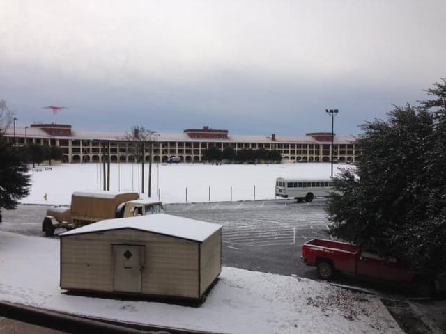
People made the best of it. You probably can’t tell from the photo, but even the officer candidates got into it, playing in the snow and organizing a snowball fight.
Late Start
Thursday’s training didn’t start until noon. We’d been slated to rappel, but that got canceled as well—and it would’ve been either way, since construction had closed the tower.
Instead, I finished the last of my inprocessing, which takes forever, and we sat through some MRT—master resiliency training.
And that was the day.
I like this video. JAGs should remember that we’re not Rangers. We’re the guys pointing toward the battlefield.
Basic Rifle Marksmanship
Friday put us back on schedule with the start of basic rifle marksmanship. The cadre issued our M-16s. (DCC is one of the few pockets of the Army that still uses the M-16; everyone else has moved to the M-4.)
We spent the morning in the classroom learning about the weapon and what was coming, then the afternoon on the firing positions we’d use to qualify.
Handling the weapons means wearing body armor, so we spent the day in full combat gear—which makes managing the rifle a bit awkward.
If I could do it over, I’d have trained beforehand in a weighted vest and a heavy pack to get used to the load. It takes some adjusting.
At the end of the day, we turned in our weapon systems—the cadre insists on “weapon system” rather than “gun,” since the optic paired with the M-16 makes it a system—and then released us for the weekend.
Next Week
Next week is devoted entirely to basic rifle marksmanship, and I expect we’ll qualify by the end of it. We also have a diagnostic Army Physical Fitness Test on Monday morning and a four-mile ruck march somewhere in the middle of the week.
As always, I’ll keep posting updates—check back if you’re interested.
DCC Land Navigation Today
I went through DCC land navigation in January 2014. More than a decade later, here is an update for anyone reporting to the course now—because a surprising amount has changed around land navigation, even as the event itself has barely moved.
What Has Changed Since 2014
Plenty has changed. I qualified on the M-16, but DCC has since moved to the M4. The fitness test has been overhauled twice, too: the APFT I took gave way to the ACFT in 2022 and then to the current Army Fitness Test in 2025, whose DCC standards I break down separately.
What Has Stayed the Same
Land navigation, though, is the constant. DCC is still a six-week course at Fort Benning run by E Company, 3rd Battalion, 11th Infantry Regiment, and land navigation is still one of its graduation requirements. The graded test is the same one I describe above: find three of five points, alone, within four hours. It is still widely considered the most-failed event at DCC—my complete DCC guide lays out the full graduation standards. The tools have not changed either. You will still plot grid coordinates on a paper military map with a protractor, shoot an azimuth with a lensatic compass, and walk into the woods to find a marker. There is still no GPS on the course—just a map, a compass, and your own two feet.
How to Prepare Today
If you are preparing for it now, train the fundamentals before you arrive. Learn to read a military map and plot a grid coordinate, practice shooting and following an azimuth with a lensatic compass, and build a reliable pace count so you always know how far you have actually walked. Get comfortable moving in low light—the test often starts before dawn, and a red-lens flashlight is dimmer than most people expect. And do not neglect your feet: as I learned on those sandy Fort Benning roads, land navigation is as much an endurance event as a technical one, so put some distance on a pair of broken-in boots. The cadre will teach you everything you need, but candidates who arrive already able to do the basics cold spend the course sharpening a skill instead of scrambling to learn it.
Frequently Asked Questions
How many points do you have to find to pass DCC land navigation?
You have to find three of five points within four hours, and you do it alone. Students practice in two-person teams beforehand, but the graded test is individual. Anyone who fails gets two more attempts before the course ends.
Is DCC land navigation hard?
Land navigation is widely considered the most-failed event at DCC. Even so, most students who show up prepared pass it. The difficulty is less about fitness than about map reading, plotting grid coordinates, and staying oriented in the woods—all skills you can practice ahead of time.
Can you use GPS during DCC land navigation?
No. It is a map-and-compass exercise: you plot grid coordinates on a paper military map with a protractor, shoot an azimuth with a lensatic compass, and navigate on foot to each point.
Do you do DCC land navigation at night?
The test often starts before dawn, so the early portion runs in the dark. You can use a flashlight, but only with a red lens—white light is not allowed on the course—and the sun usually comes up within an hour or so of starting.
How should I prepare for DCC land navigation?
Learn to read a military map and plot a grid coordinate, practice shooting and following an azimuth with a lensatic compass, and build a reliable pace count. Get comfortable moving in low light, and put some miles on a pair of broken-in boots—land navigation is as much an endurance event as it is a technical one.
For a more expansive account of my experience, see my book The DCC Survival Guide: Succeeding at the Army’s Direct Commission Course and its companion work The JAG School Survival Guide.
The views and opinions expressed in this post are the author’s own and do not reflect the official policy or position of the United States Army, the National Guard Bureau, the Arkansas National Guard, the Department of Defense, or the United States Government.

Garrett Ham
Garrett Ham is an attorney, military veteran, and holds a Master of Divinity from Yale Divinity School. He writes from Northwest Arkansas on theology, law, and service.
Related Posts
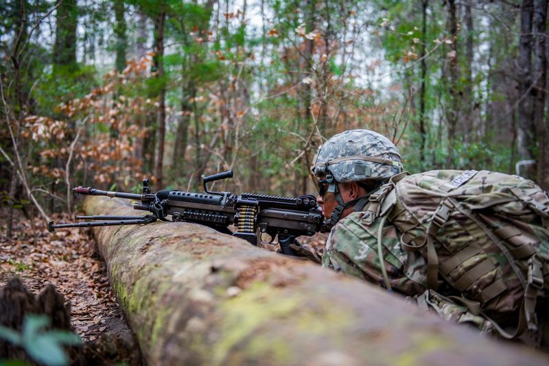
Rifle Marksmanship and Week 4 of DCC
Week 4 of the Army Direct Commission Course is a compressed Basic Rifle Marksmanship block on the M-16 — zero, practice, and qualification.
Week 2 of the Army’s Direct Commission Course (DCC)
A JAG officer’s firsthand Week 2 guide to the Army’s Direct Commission Course (DCC) at Fort Benning: land navigation, first aid, CIF gear issue, and PT.
DCC Packing List: The Complete Interactive Checklist
An interactive packing checklist for the Army's Direct Commission Course (DCC) at Fort Benning — documents, uniforms, personal items, training supplies, and prohibited items.
Stay Informed
Get new writing on faith, law, and service delivered to your inbox.
No spam. Unsubscribe anytime.